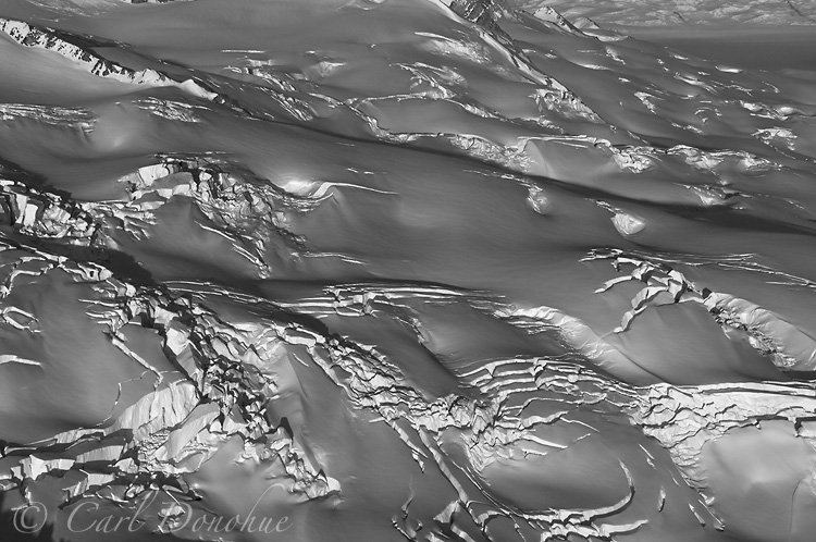
The Bagley icefield and its crevasses
127 miles long, 6 miles wide, and up to 3,000 ft thick, the Bagley Icefield is the largest nonpolar icefield in North America. How enormous is it? Consider that Seward Glacier, Malaspina Glacier (the largest piedmont glacier in the world – there remains some discrepancy here, the glacier does actually carve into tidal water) and Bering Glacier all ultimately find their source from Bagley Icefield. Bagley Icefield is also the source of countless other glaciers in the St. Elias and eastern Chugach Mountain Ranges; a strip of land that is the most heavily glaciated landscape on the continent. Bagley Icefield drains all four directions from the mountains, dropping into glaciers that glow south and east, empty directly into to the Pacific, or north and west and more indirect routes to the ocean.
All this information is simply a way of saying Bagley Icefield is one of a kind. I’ve not yet (as of this writing anyway) traversed this icefield completely on foot, but I hope to do so one of these days; along with about a hundred (and counting) other adventures in the area that spring to mind.
This photo was taken on an aerial shoot down in the St. Elias Range one fall afternoon. I’ve flown over the Bagley Icefield a good number of times, and it amazes me still. Incredible landscape.
Aerial photo of Bagley Icefield and crevassing on the ice. Wrangell-St. Elias National Park and Preserve, Alaska.